- 5 Days
- 5160m
Manaslu is the Eighth-Highest Mountain in the World at 8,163 m above Sea Level. Trek from Samdo to Tibet Rui la Pass, which is around 5000 mt, is still a dream for many trekkers around the world. Manaslu is the world’s eighth-highest peak and is above 8000m. Local People name this mountain Kutang. This Mountain is part of the Nepalese Himalayas. The name Manaslu has a unique meaning, which is “Mountain of the Spirit,” which is derived from the Sanskrit word manasa, meaning “intellect” or “soul”.
In the Mountaineering community, it is famously known as the ‘Killer Mountain’ due to its high rate of death and low summit rate. It is the highest peak in Gorkha District and is approximately 64 km away from Annapurna mountain, the tenth-highest mountain in the world.
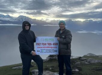
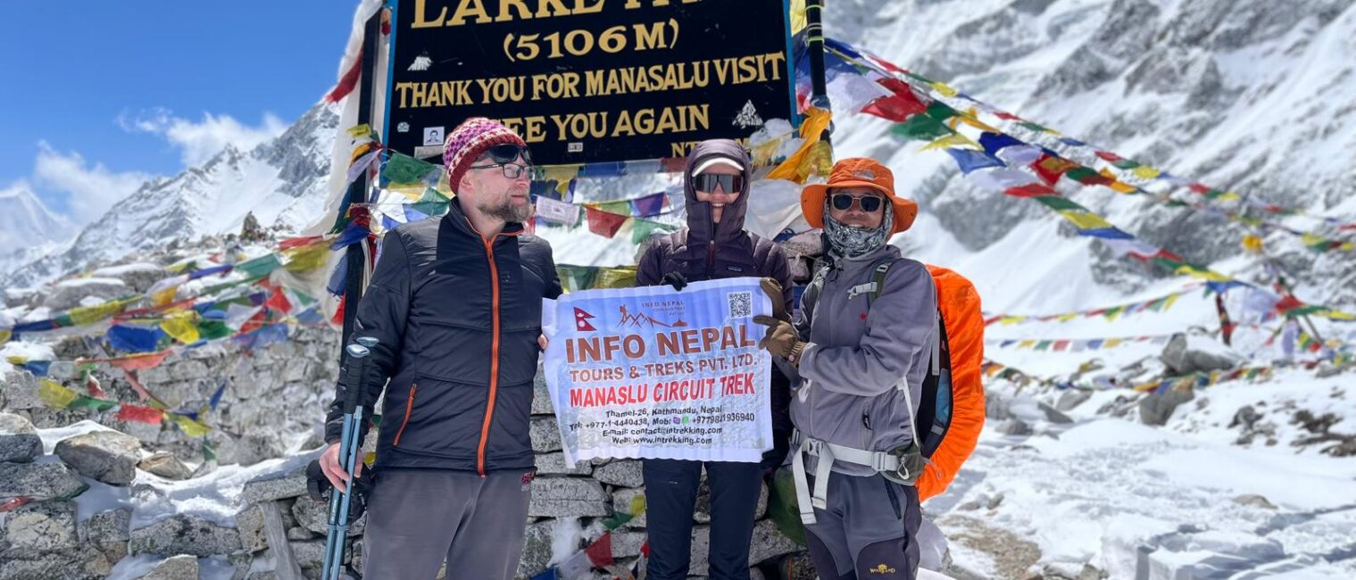
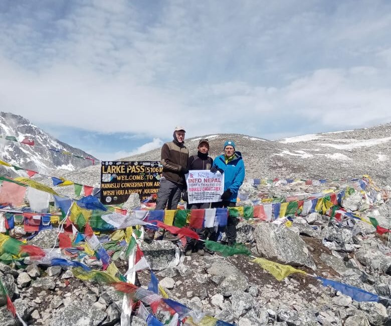
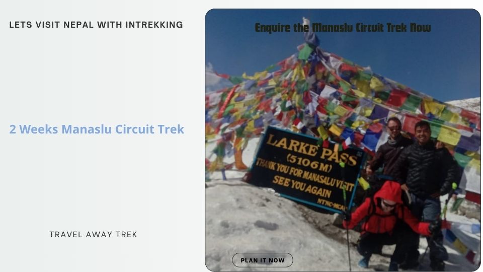
The Manaslu Region offers various Trekking options, and we focus here on our 13-day Manaslu Circuit Trek. The popular Manaslu massif passes through the highest point, Larkya Pass, at 5,064 meters, and then descends to the Annapurna region.
This trekking Trail was opened in 1991; before that, it was not allowed to enter the area. To trek around the Manaslu Circuit, you will need restricted permits, and individual trekkers cannot enter the area alone. Every Trekker should at least have a partner with him/her and a Guide/Porter.
The Manaslu Circuit Trekking trail of 177 kilometres follows an ancient salt trading route along the Budi Gandaki River. This route passes through 10 peaks over 6500m that are visible along the trip, and a few 7000m peaks.
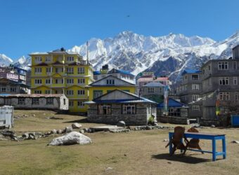
Manaslu Circuit Trek starts from Soti Khola and ends at Besishahar, also the starting point for the Annapurna Circuit Trek. This two-week Trek takes you to the amazing valley and Mountains along with the Budi Gandaki River.
This route follows the ancient salt trading route. From Deng, the slope of the Ravines decreases, and the view of Snow Peak starts appearing from Lhi. After passing Lhi and reaching Lho, the stunning view of Mount Manaslu appears.
From here onwards, you pass through the pine forest in Syala Village and to the Sama Gaon, which is at the foot of Mount Manaslu. You then reach Samdo, the highest village in the Budi Gandaki Valley. Samdo is mostly inhabited by the Tibetan people. From the village, the valley looks stunning, along with the Pangh Phuchi Village, with the Tibetan border visible.

Best Alternative Treks
For the cost price, please check out here.

13-day Manaslu Circuit Trek outline itinerary
In the evening group welcomes dinner in a nice authentic Nepalese restaurant with a cultural program to give you a glimpse of local culture with music and dance while having your dinner. Tonight We will have briefing on our next day 13 days Manaslu Circuit Trek.
Today will embark on a captivating journey from the vibrant city of Kathmandu to the tranquil village of Machha Khola, a drive that will take us approximately 7 to 8 hours. As we set off, the bustling streets of Kathmandu will soon give way to the serene beauty of Nepali countryside. The route follows the enchanting Seti Khola, its crystal clear waters flowing alongside us, creating a picturesque backdrop for our adventures.
As we make our way will pass through the lively Arughat town, Where we can glimpse the rich local culture and the everyday life of the villagers. The town is a hub of activity with traditional houses, quaint shops and smiling faces all around, making it a beautiful and delightful stop along our journey. The vibrant landscapes of terrorist fields and rolling hills will surround us, offering beautiful views at every turn.
Upon reaching Machha Khola, we will be welcomed by its peaceful atmosphere and stunning natural scenery. After a long day on the road, we can relax and unwind in the charming village, preparing for the exciting adventures that lie ahead. Our 13 days Manaslu Circuit Trek starts from today.
From here walk upstream towards Bensi village a place with a natural hot spring known as ‘Tatopani’ in Nepali. The walk continues where the valley becomes narrow and crosses over a bridge to reach Doban located on a high shelf of Budigandaki River, with refreshing stops walk leads across Lauri stream to cross again over bridges and then descends into an open valley of Yara Khola, then walk for another hour to reach Jagat village for an overnight stop.
Jagat a nice-looking farm village of moderate size after Arughat; people are of mixed race with Magar, Chettries, Brahman, Manaslu Bhotia (Tibetan-looking tribes), and some Newar people.
The journey begins in Jagat village, where the morning trail ascends towards a higher hill, revealing the picturesque landscape of rural farm villages. After a descent that crosses a bridge towards Nagjet, trekkers will walk past Philim, a charming village known for its scattered houses and atmosphere.
Continuing from Philim, the path takes you around beautiful farm terraces filled with golden fields of wheat and barley, showcasing the abundance of agriculture in the area. The vibrant colours and serene surroundings create a captivating scenery as you make your way further along the trail.
As the climb progresses, the route leads above a rocky ridge and into lush bamboo forests, offering a refreshing respite as you approach your destination. Finally, the trek culminates in Dyang village, where you can settle in for sn overnight stop, surrounded bu the tranquility of nature.
After Ghap enters into alpine woodland the trail meanders to climb as the valley opens out and crosses a large stream flowing from Lidana Peak glacier.
On walks views of Manaslu the local name is Kutang (Manaslu) with Pang Phuchin 6,335m, Saula Himal 6,235m with a range of unnamed peaks, walk from here on a slow uphill as altitude gains slowly heading past farm village to reach Namrung for overnight stop, this village with another name as Sho Namru.
With a pleasant, stop at Namrung, The morning unfolded as we travelled through expensive farm fields dotted with Yak herder huts and shelters. During summer, the locals of the Manaslu Valley are deeply engaged in farming, Showcasing the vibrant agricultural life of the region. This picturesque setting provides a glimpse into the daily activities and traditions that shape the community.
Continuing our trek, we make our way to Lo-Gaon, a charming village nestled in the high Manaslu Valley, where we will spend the night. This scenic local offers breathtaking views of the towering Manaslu North Face, creating a stunning backdrop that enhances the village’s appeal. The tranquillity of Lo-gaon makes it an ideal stop for reflection and appreciation of the natural beauty surrounding us.
While in Lo-Gaon, We take the opportunity to visit the village’s oldest monastery, an intriguing site that adds to the cultural richness of the area. The monasteries are adorned with numerous chorten and Mani-walls, Which not only serve as a spiritual marker but also provide stunning views of the Ganesh Himal in the east. This visit allows us to connect with the local heritages and serene atmosphere of the remarkable region.
In the morning you start your trip from lo-gaon along the gradual path That ascends gently,Providing stunning views are peak 29. This peaceful morning walk allows you to immerse yourself in the natural beauty of the region. After several hours of scenic hiking, you’ll enter a small forest near Shala Village, where you can revel in excellent views of Phungi, Manaslu, and Himal Chuli, making it a perfect spot for photography and nature enthusiasts.
As you continue your journey, the path winds to breathtaking landscapes For a few hours offering a unique hiking experience. The combination of serene atmosphere and majestic Mountains will captivate your senses, encouraging you to appreciate the exceptional beauty of the Himalayas. Each step brings a new opportunity to discover the diverse flora and fauna that thrive in this remarkable environment.
Eventually, your trek will lead you to Sama-Gaon, a charming village known for spectacular close-up builds of Mount Manaslu. This idyllic location is perfect for unwinding after a rewarding day of trekking. Whether you’re seeking adventure or simply want to soak in the majestic scenery, Sama Gaon provides a tranquil setting to reflect on your experiences and connect with stunning Himalayan landscapes.
At Samagaon village, trekkers can take a well-deserved rest day for acclimatization before the ascent to the high Larke La pass. This charming village, nestled in the scenic Manaslu valley offers visitors a chance to explore ancient Nyligpa Monastery,Which belongs to the red hat sect of Buddhism. With origins stretching back around 400 years, the monastery reflects the rich cultural heritage of the idea. Reminiscent offers Tibetan Buddhist roots, Making it an essential stuff for anyone interested in the spiritual history of the region.
The local villagers in the region are deeply connected to its history, as their ancestors migrated from southwest Tibet and have preserved their traditions over the centuries. This community is actively engaging in trade and bartering with Tibet. Taking advantage of their unique positions along the old Trans-Himalayan salt trade route. The vibrant cultural exchange not only enriches the lives of villagers but also attracts visitors who are eager to learn about the age-old customs and practices still in place today.
Exploring Sama-Gaon offers a glimpse into a way of life that blends stunning natural beauty with a profound cultural legacy. The interaction between the villagers and their environment creates a harmonious lifestyle, steeped in tradition. Trekking through this area provides an unparalleled opportunity to experience the unique blend of history and culture that defines the Manaslu Valley, Making it a must-visit destination for adventure seekers and cultural enthusiasts alike.
As you continue your trek, the trail winds to diverse terrains, showcasing the raw beauty of the Himalayas. Moderate climb leads you to a small flat plateau where Samdo village awaits. The quaint village consists of over forty houses with around two hundred residents, offering a glimpse into life in this changing at beautiful environment.
Visiting Samdo is more than just a trek there’s an opportunity to experience the rich culture and resilience of the Himalayan people. This adventure is filled with unforgettable memories and a deeper appreciation for Nepal’s breathtaking landscapes. Whether you are an experienced trekker or a newcomer, this journey promises a rewarding experience.
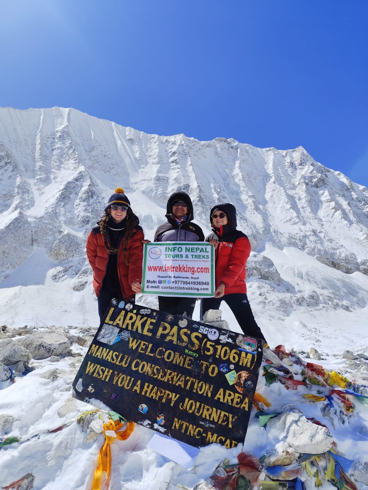
A walk continues crossing a few icy streams to reach Larke Phedi means the bottom of the pass, also known as Dharmasala means ‘travellers’ rest house/shade’, where in early days also called Larke Bazaar, (where trade and bartering were held between merchant-traders of Gorkha-Manaslu-Manang people and Tibetans on this remote isolated spot).
At Larke, Phedi afternoon is free for short walks and preparations for the next early morning long climb and descent crossing the high Larke-La pass to reach Manang areas.
From the top of Larke-La panorama of Himlung, Cheo Himal, Kang Guru, and Annapurna II includes a series of Manaslu peaks and then descends back into tree lines through Larcia, as walks lead on moraine ridge to Tambuche at the bottom of Larke-la pass, where a short walk takes you at Bhimthang for overnight.
Bhimthang is a wonderful spot situated on a wide green valley with several lodges adorned with prayer Mani walls, surrounded by green tall trees of rhododendron pines and oaks.
From Tilje shortstop climbs for a short while after crossing over a bridge to reach the nice village of Dharapani located on the junction of the popular Annapurna and Manaslu circuit route with the district of Manang.
After the refreshing break at Dharapani drive following Masrsyangdi River downstream to reach the low warmer farm area and a large area of Besisar, a headquarters town of Lamjung district with overnight stops in a nice lodge and hotels.
We will conclude our exciting adventure at the breathtaking foothills of Manaslu. Enjoying a scenic morning drive back to Kathmandu where you will experience the beauty of charming farm villages and vibrant towns along the road.
Upon arrival in Kathmandu, you will be transferred to your hotel for check-in in the afternoon is yours to explore individual activities and discover local culture at your leisure. We’ll gather for a delightful farewell dinner in the evening providing the perfect end to an unforgettable journey through the stunning landscapes of Mobile.
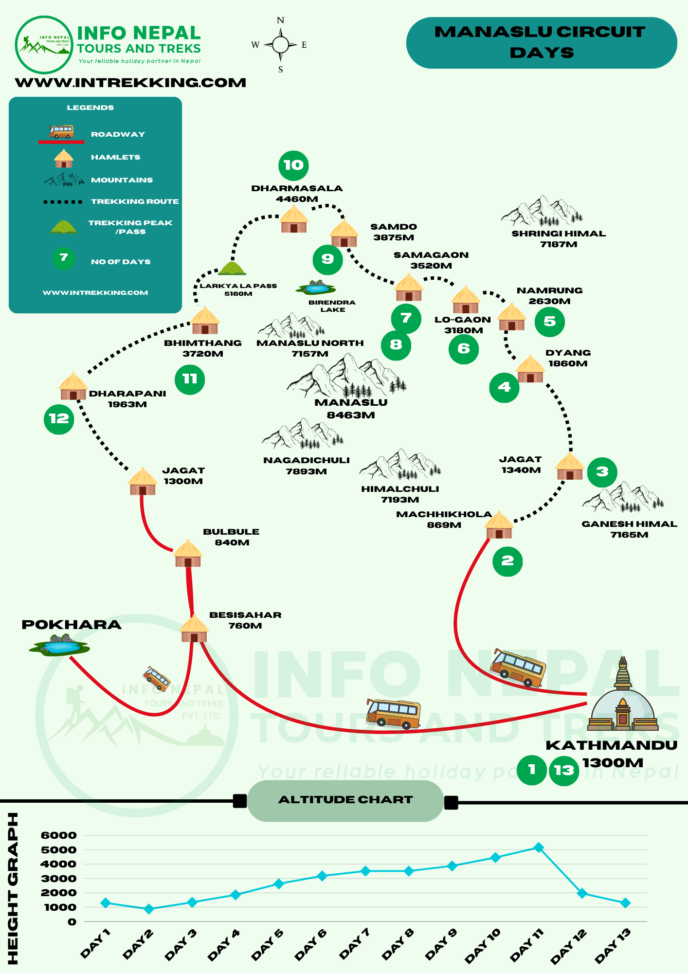
Starting in Kathmandu (1,300m) on day 1, the trek progresses across key stops like Machhakhola (869m) on day 2, Jagat (1,300m) on day 3, and Deng (1,860m) on day 4.
The route ascends to Namrung (2,630m) on Day 5, Lo Gaon (3,100m) on day 6, and Samagaon (3,520m) on day 7. Day 8 includes a rest day in Samagaon, followed by Samdo (3,860m) on Day 9 and Dharmasala (4,460m) on Day 10. The highest point, Larkya La Pass (5,106m), is reached on Day 11, descending to Bhimtang (3,720m). The trek continues to Dharapani (1,860m) on Day 12, ending in Besisahar (760m) on Day 13, with a return to Kathmandu. An altitude chart at the bottom tracks elevation changes, peaking at Larkya La Pass. The map highlights trekking routes, roads, and notable peaks like Manaslu (8163m) and Himlung Himal (7,162m)
| Start Date | End Date | Availability | |
|---|---|---|---|
| 15 Jun, 2026 | 27 Jun, 2026 | OPEN | Book Now |
| 10 Jan, 2027 | 22 Jan, 2027 | OPEN | Book Now |
| 12 Jan, 2027 | 24 Jan, 2027 | OPEN | Book Now |
| 17 Jan, 2027 | 29 Jan, 2027 | OPEN | Book Now |
| 19 Jan, 2027 | 31 Jan, 2027 | OPEN | Book Now |
| 1 Feb, 2027 | 13 Feb, 2027 | OPEN | Book Now |
| 6 Feb, 2027 | 18 Feb, 2027 | OPEN | Book Now |
| 14 Feb, 2027 | 26 Feb, 2027 | OPEN | Book Now |
| 16 Feb, 2027 | 28 Feb, 2027 | OPEN | Book Now |
| 27 Feb, 2027 | 11 Mar, 2027 | OPEN | Book Now |
| 1 Mar, 2027 | 13 Mar, 2027 | OPEN | Book Now |
| 14 Mar, 2027 | 26 Mar, 2027 | OPEN | Book Now |
| 1 Apr, 2027 | 13 Apr, 2027 | OPEN | Book Now |
| 9 Apr, 2027 | 21 Apr, 2027 | OPEN | Book Now |
| 17 Apr, 2027 | 29 Apr, 2027 | OPEN | Book Now |
| 18 Apr, 2027 | 30 Apr, 2027 | OPEN | Book Now |
| 24 Apr, 2027 | 4 May, 2027 | OPEN | Book Now |
| 27 Apr, 2027 | 4 May, 2027 | OPEN | Book Now |
| 1 May, 2027 | 13 May, 2027 | OPEN | Book Now |
| 14 May, 2027 | 26 May, 2027 | OPEN | Book Now |
| 15 May, 2027 | 27 May, 2027 | OPEN | Book Now |
| 17 May, 2027 | 29 May, 2027 | OPEN | Book Now |
| 19 May, 2027 | 31 May, 2027 | OPEN | Book Now |
| 2 Jun, 2027 | 14 Jun, 2027 | OPEN | Book Now |
We have been asked many questions regarding altitude sickness during the Manaslu Circuit. It is not recommended for those with any medical condition. People with diabetes, Asthma, and other related diseases are at risk of doing this high-altitude trekking. Even normal people are severely affected by the high altitude.
Altitude/ elevation sickness, also known as acute mountain sickness (AMS), occurs when you ascend to high altitudes too quickly and your body struggles due to a lack of adequate oxygen. It typically affects people after ascending beyond 2500 metres (8,200 ft) and can escalate if ignored.
Symptoms usually begin 6-24 hours after ascent and to help control the situation can range from mild to life-threatening. It’s crucial to recognise early signs to take the situation under control.
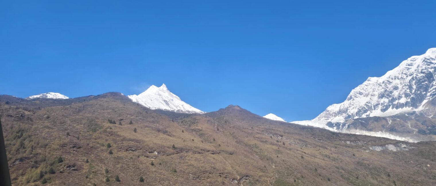
The Manaslu region, located in the west-central part of Nepal, is dominated by the colossal Manaslu mountain, standing at 8,163 meters (26,781 feet) and is the eighth-highest peak in the world. This awe-inspiring giant is part of the Mansiri Himal range in the Himalayas. The region isn’t just about Manaslu itself; it also boasts a collection of other notable peaks, including Himalchuli (7,893 meters), Ngadi Chuli (7,871 meters), and Shringi (7,161 meters), each contributing to the breathtaking skyline and the allure for mountaineers and trekkers alike.
The glaciers in the Manaslu region are equally captivating, playing a crucial role in the area’s ecosystem. These glaciers, including Manaslu Glacier and Pungyen Glacier, are sources of major rivers and streams. They feed into the Budhi Gandaki River, which carves its way through deep gorges and valleys, providing water for the lush landscapes and the communities that call this region home.
As you trek through the Manaslu region, you will be welcomed by an array of lush valleys and expansive forests. The Budhi Gandaki Valley is one of the principal features, offering a diverse ecosystem ranging from subtropical jungles at lower elevations to alpine meadows as you ascend. The varied climate across the valley ensures an equally diverse array of flora and fauna.
The lower regions are dense with rhododendron forests, bamboo groves, and oak trees, creating a forested paradise for nature enthusiasts. The higher forested zones introduce a mix of fir, juniper, and birch trees. During spring, these forests are a painter’s palette with blooming rhododendrons adding bursts of red, pink, and white to the green backdrop.
Nestled within this dramatic geography are charming villages that reflect the region’s rich cultural tapestry. Villages like Sama Gaun, Lho, and Samdo offer glimpses into the lives of the local people, predominantly of Tibetan origin. These villages are framed by terraced fields, stone-built homes, and ancient monasteries that stand as testaments to the region’s spiritual and cultural heritage.
The monasteries, such as the Ribung Gompa in the village of Lho, are not just religious centres but also cultural hubs where festivals, dances, and rituals keep the traditions alive. Trekking through these villages provides a unique opportunity to witness and participate in the local traditions, making it an enriching add-on to the natural beauty surrounding you.
The trails and mountain passes of the Manaslu region offer both challenges and rewards for adventurous spirits. The most notable is the Larkya La Pass, sitting at 5,160 meters (16,929 feet) and serves as the highlight of the trek, offering breathtaking views of Himlung Himal, Cheo Himal, Kang Guru, and Annapurna II. Crossing Larkya La is a test of endurance but comes with the ultimate reward—panoramic views that will leave you spellbound.
Throughout the trekking trails, you’ll encounter suspension bridges, cascading waterfalls, serene lakes, and wide-open meadows. Each step along the rugged paths unravels new vistas and opportunities to connect with nature in its most rugged and unspoiled form.
The Manaslu region offers a unique trekking experience with stunning natural wonders and rich cultural heritage. With its towering peaks, lush forests, and challenging trails, it guarantees the adventure of a lifetime.
The climate in the Manaslu area features both snowfall and rainfall, creating a diverse weather pattern. At elevations above 5000 meters, the landscape is perpetually covered by a snowline, offering stunning, snow-capped views year-round. Within this climatic zone, the monsoon season begins in June and runs through September, bringing significant rainfall to the region during these months.
The conservation area of Manaslu is at the Sub-tropical Himalayan foothill to the Trans-Himalayan high pasture bordering Tibet. From Arughat to the Larkya Pass, the area covers 6 climatic zones. The Tropical and sub-tropical, the temperate zone, the sub-alpine zone, the alpine zone, and the arctic zone. All these zones differ in varying altitudes.
At elevations above 5000 meters, you’ll encounter a snowline that remains year-round. This means the towering peaks and vast expanses at these high altitudes are always draped in a pristine layer of snow, offering breathtaking, snow-capped vistas no matter the season. It’s like stepping into a winter wonderland that’s timeless and majestic.
During the monsoon season, which starts in June and continues through September, the region sees significant rainfall. These months transform the landscape even further, nourishing the lush greenery and adding a certain freshness to the air. The rains bring a different kind of beauty to the Manaslu Circuit, with waterfalls springing to life and rivers bustling with newfound vigour.
This combination of permanent snow at higher altitudes and seasonal rains lower down creates a unique, dual personality for the climate in the Manaslu area. Whether you’re trekking through snow-covered paths or lush, rain-soaked trails, the weather conditions add depth and diversity to your adventure, making each visit a new and captivating experience.
The region of Manaslu is rich in cultural diversity, with two primary ethnic groups mainly inhabiting the areas of Nubri and Tsum. In the central region of Manaslu, the Gurungs are the predominant ethnic group. This community is well known for its warm hospitality and traditional practices, which play a significant role in the cultural tapestry of the area.
As you move closer to the Tibetan border, the landscape and cultural influences begin to shift. Here, you’ll find the Bhutia people residing. The Bhutias share many similarities with the Sherpa groups, both of which belong to the broader Tibetan ethnicity. This cultural connection is evident in their language, lifestyle, and religious practices.
The entire Manaslu region is dotted with vibrant symbols of Buddhism, reflecting the deep spiritual connection of its inhabitants. You will encounter numerous monasteries, each serving as a centre of worship and community life. Mani walls, inscribed with sacred mantras, line many of the pathways, offering blessings to travellers. Chortens, or Buddhist shrines, are scattered throughout, each one a testament to the region’s rich religious heritage. These landmarks not only add to the scenic beauty of Manaslu but also provide a glimpse into the spiritual life that permeates the daily existence of its people.
Adventurers are likely to encounter a staggering array of wildlife. The Manaslu Valley serves as a crucial sanctuary for numerous endangered animals. Among the most notable residents are the elusive Snow Leopards and the charming Red Pandas.
The valley also supports a rich diversity of mammals. Visitors might spot the stealthy and rarely seen lynx, the formidable Asian black bear, or perhaps a herd of graceful blue sheep navigating the rugged terrain. The region is also home to the elusive Himalayan musk deer, the sure-footed Himalayan Thar, and the agile Himalayan goral, among many others.
Bird enthusiasts will be thrilled to learn that the area boasts over 110 species of birds, making it a paradise for birdwatching. Additionally, butterfly lovers will find the region equally appealing, with 11 butterfly species recorded, including three unique species that have only been documented in this particular area. The combination of these varied mammals, birds, and butterflies creates a vibrant tapestry of life, offering nature lovers plenty of opportunities to observe and appreciate the rich biodiversity that thrives in the Manaslu Valley.
If you’re seeking luxurious accommodations during the Manaslu Circuit Trek, this might not be the trip for you. The mountain landscape offers simple yet cosy tea house lodges that are designed to provide trekkers with the essentials after a long day on the trail. These lodges often feature shared bathrooms, which, while basic, are clean and functional.
Nights up in the mountains can be quite chilly, so it’s important to come prepared. The tea house lodges do their best to keep you warm, usually offering extra blankets to help stave off the cold. However, it’s worth noting that the heating is generally only available in the communal dining area, which becomes a popular spot for trekkers to gather, warm up, and share their stories from the day.
Although the accommodations might be simple, the experience of staying in these teahouse lodges is part of the charm and adventure of trekking in the Himalayas. It offers a unique opportunity to connect with fellow trekkers and experience the local culture up close.
When planning your adventure to the stunning Manaslu Circuit, you’ll be pleased to know that we offer several convenient transportation options to ensure a smooth start to your journey. You can choose between a private Jeep and a shared bus service, depending on your preferences and budget.
If you opt for a private Jeep, the drive to the trekking starting point will take approximately 6 hours. This option offers more comfort, flexibility, and a quicker commute, allowing you to begin your trek refreshed and ready for the exciting path ahead.
For those looking for more economical choices, we also provide a shared bus service. While this option takes a bit longer—around 8 to 9 hours—it allows you to savour the scenic beauty along the way and offers opportunities to meet fellow adventurers who might be joining you on the trek.
To make your trip as seamless as possible, you can contact us in advance to book your transportation. Alternatively, you can book your trek directly with us, and we’ll take care of all the details, including transportation, as part of your itinerary.
Feel free to reach out with any questions or to secure your bookings. We’re here to help you go on this incredible adventure with ease!
The best time to do Manaslu is in Spring and Autumn. Spring from March to May and Autumn from mid-December to mid-January.
During these periods, the weather is typically stable, and the skies are clearer, offering stunning mountain views that the Manaslu Circuit is famous for. Springtime brings the added beauty of blooming rhododendrons, adding vibrant colours to the landscape. Autumn, on the other hand, provides crisp, clean air and the spectacular sight of snow-capped peaks.
Travelling during these seasons usually means fewer risks of landslides and avalanches, which can be more common in the monsoon season (June to September) and winter months (mid-December to February). While the monsoon season brings lush green scenery, it also makes for difficult trekking conditions with muddy trails and leeches. Winter treks are possible but require special preparations for colder temperatures and the likelihood of heavy snowfall obstructing paths.
Choosing either Spring or Autumn ensures a safer and more enjoyable trekking experience, maximising the breathtaking vistas and cultural encounters along the Manaslu Circuit.
Related: Manaslu Circuit Trek in September | Manaslu Circuit Trek in March
If you’re considering booking a Manaslu Circuit Package, Info Nepal has some fantastic offers for all travellers keen to explore this stunning region. We provide a comprehensive range of services, ensuring your journey is smooth from start to finish, starting with an airport pickup and continuing to your departure drop-off.
To get started on your incredible adventure, all you need to do is drop us an email or give us a call at (+977) 9841936940 or [email protected]. Our team prides itself on responding quickly, so you can expect to hear back from us in no time at all.
As soon as you reach out, the dedicated team at Info Nepal will attentively listen to every detail of your requirements. We’ll work closely with you to tailor our services and make sure everything is customised to meet your specific needs. Our goal is to turn your vision into reality and ensure that your adventure is everything you’ve dreamed of and more.
Our experienced guides are well-versed in the intricacies of the Manaslu Circuit, and they’re eager to share their knowledge with you. Whether you’re a seasoned trekker or a beginner looking for your first big mountain adventure, we’ve got you covered.
We offer various packages that can be adapted to suit your schedule, budget, and preferences. From arranging permits and transportation to providing accommodation and meals, our team takes care of all the details. You can focus on enjoying your trek, knowing everything else is handled.
Booking a trip with Info Nepal means you’re not just signing up for a trek; you’re joining a community of passionate explorers. Our past travellers often share their stories and tips, and our online forum allows you to connect with others who have completed or are planning the same journey.
If you have any questions before making your decision, don’t hesitate to reach out. Info Nepal’s supportive staff is always available to answer queries, offer advice, and provide any additional information you might need.
The 13-day Manaslu Trek is in a Restricted area, so you will require the Restricted area permits to do this trip. In total, there are 5 permits you will require during the Manaslu Circuit Trek. Manaslu Conservation Area Project permits the Annapurna Conservation Area Permit, the Manaslu Restricted Area Permit, and the TIMS card.
Before starting the Trek, trekkers need to get a few important permits. Knowing these requirements helps make the adventure in the beautiful Nepalese Himalayas smooth and enjoyable.
The Manaslu region is classified as a restricted area, which means you’ll need a special permit to explore this beautiful territory. The permit cost varies depending on the season:
This Trek passes through the Annapurna Conservation Area, so securing an ACAP is necessary, costing around:
Cost: USD 30 per person
In addition to the ACAP Permit, trekkers also need a permit for the Manaslu Conservation Area:
Cost: USD 30 per person
With your permits sorted, you can look forward to an awe-inspiring trek through remote villages, lush valleys, and up to majestic mountain passes. Get ready for an unforgettable journey in one of Nepal’s most pristine regions!
Hands
Footwear
Toiletries
Additional
Our 13-day Manaslu Trek requires some effort, but it will be much easier for you to do this trip. Hats, Sunglasses, Down Jackets, Hiking Boots, Medicines, Water bottles, Trekking poles, Crampons, Trousers, T-shirts, Thermal sets, and hiking socks are mostly required during the trip.