- 9 Days
- Lauribina La Pass (4,610m/15,124ft)
Adventure and expeditions, there are many in Nepal.
Looking for something unique? We’ve got something for you.
If you are a traveller who prefers well-rounded trek, as in, loves to try the adventure, seeking new, unique cultural practises and prefers solitude in the mountains, the Tamang Heritage Gosaikunda Lake Trek, right here, is the perfect package for you. Just like described above, it’s a blend of culture, solitude, and adventure. And something not to be missed and worth mentioning is the wildlife. It’s unique.
Not just unique but fascinating, so if you’re a wildlife photographer building a portfolio, this might be a good spot for you.
So without further ado, let’s dive deep and explore some of the fascinating sites to explore on this trail.
Highlights, they don’t just come in a single category in here; it’s like winning a lottery. It’s a blend, a fusion of nature, culture, and arts. So let me help you break this down. First of all, let’s talk about the culture.
From my personal pov, it’s a Living museum, I mean, why wouldn’t it be right to call it so, when it’s no less than a time capsule of architecture and artistic works.
It has cultural practises and rituals from centuries ago that people even follow today as part of their lives, which is why I called it a time capsule, cause that’s what it feels like when looked upon. As if frozen from the past, untamed by the time and forces of nature. But still moving.
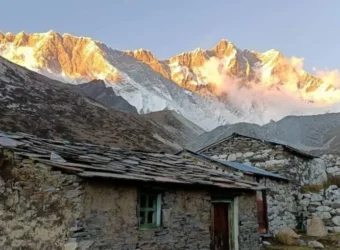
The villages of Gatlang and Thuman. These aren’t just stops; they are architectural time capsules. Stone-built houses, intricate wooden carvings, and a reflection of the unique Tamang-Tibetan blend.
Another section of this part is nature’s warmth. A natural hot spring, Tatopani, wouldn’t be a mistake to call a healing station. Mineral-rich water, submerge in it, give it a try for once at least, and you’ll notice the surge of blood flow back in your body and every joint healing and muscles as if they got new life.
And to top it off with a visual feast, the Nagthali Viewpoint (3,165m)is the peak of this portion of the trip. Oh yeah, and cherry on top, when you get the “theatre-like” view of Ganesh Himal and other peaks bordering Tibet.
It will be worth it to call a high-alpine spectacle, the village of Langtang, a place and point in the trek full of natural attractions, so something you’ve gotta try personally, like tasting the local delicacies, makes the list.
Let’s start with Kyanjin Gompa, at an altitude of 3,870m, almost 4,000m. An ancient monastery and legendary Swiss-inspired Yak cheese factory, something you should have on your bucket list, a must-try. They call it fuel for trek.
And here comes the Tserko Ri Ascent (5,033m), your ultimate peak objective of the trek. Reaching the summit is like a high-level of experience, and I’m telling you so because it really is.
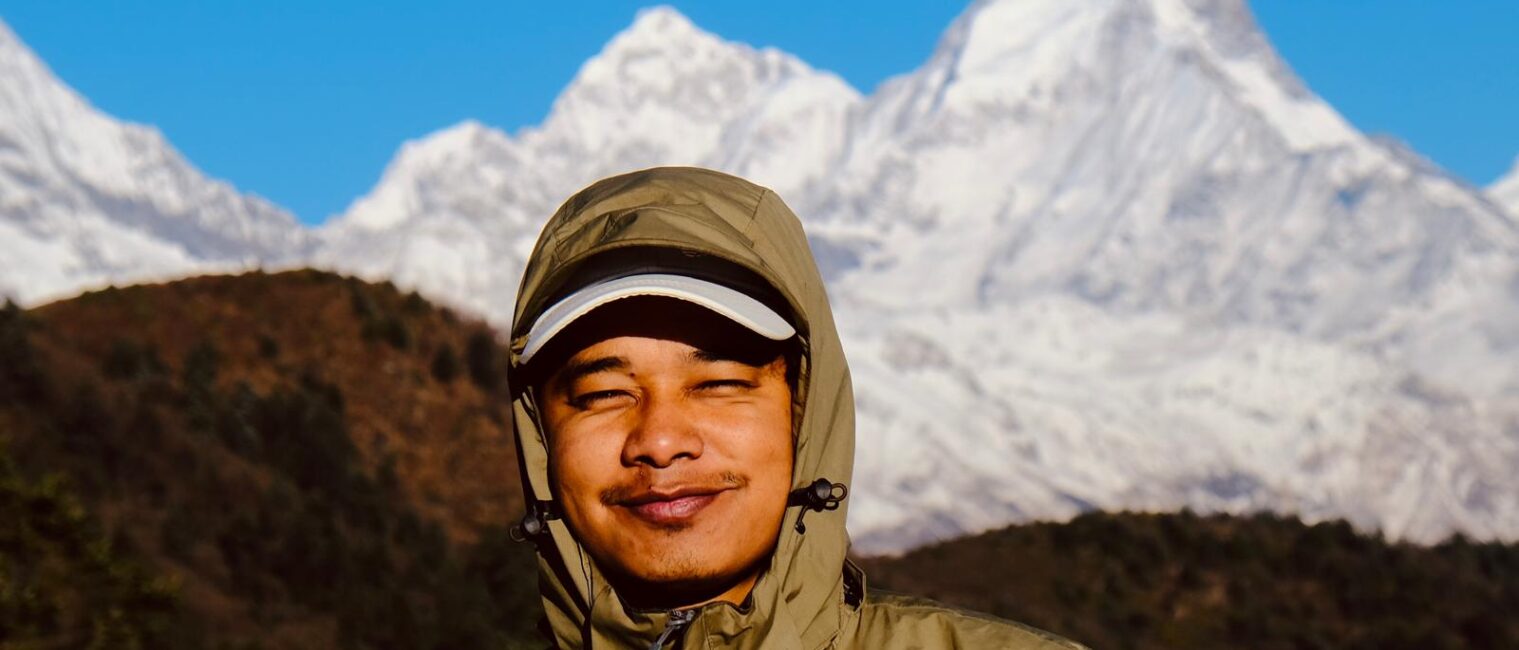
Imagine living in the lowlands for the majority of life and then on a trek crossing 5,000m, an elevation where things feel unreal, where snow-covered rocks pierce the clouds. You stand and watch, and all you can see is white peaks around, a panorama of mountains and glaciers like Lirung Glacier.
It’ll be a tale to tell your friends back at home.
The highlight, hard to find, Red Panda, is elusive, like rarely spotted, and just tries to avoid any human interaction. If you’re someone with a photography background, enthusiasm, and an interest in wildlife, keep your lens ready. If you’re in pursuit of snapping its picture, then you gotta stay vigilant, or else it’s never there to snap a pic.
Now let’s talk about something that holds cultural significance, the “Holy water of Gosaikunda”. Kunda, meaning lake/pond in Nepali. At an altitude beyond the normal level of oxygen. It’s cold, no matter the time, it’s cold. As for water, it’s turquoise, appearing as if it froze in time. A special sight to witness is that it’s surrounded by 108 small lakes.
Lauribina Pass, above 4,000m, trekking up to here, is a high-intensity workout, not some gym and dumbbells. It’s gonna make you drool if you’re not fit and healthy. When you get up there finally, the view of the ranges is just wow.
Let’s talk about how it starts.
You arrive at the Tribhuwan International Airport, Mr Rajesh, the owner of Intrekking, will be present there by himself to receive you on a private ride towards his office and your hotel.
After you arrive at his office, you’ll have time for a discussion about the trip and preparation for the next day.
Your equipment will be checked thoroughly with a checklist ready for items required, and all the payments will be carried out, as well as a small and short meeting with your designated guide and the rest of the crew members.
Following the meeting,g you’ll have the rest of the evening for yourself to get around the streets and enjoy some local feasts and time to refresh your taste buds.
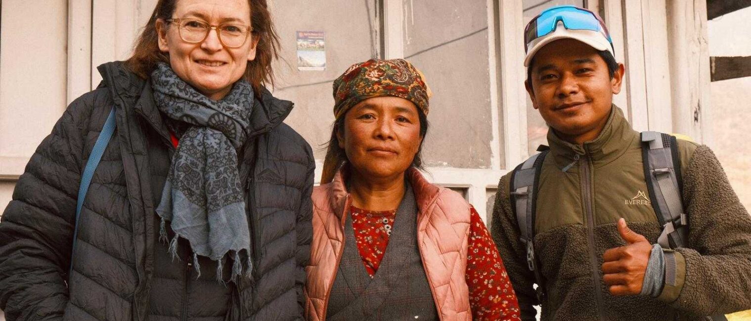
Have a gander around, communicate with locals, the people in Nepal are known for their warm and friendly nature.
So it’s officially the first day and commencement of your trip, and it starts with a drive to Syabrubesi.
The drive goes by the Trishuli River on a winding road. Grab a window seat and enjoy the view and the fresh air gushing and touching your face. It feels really like a fresh start of something beautiful and peaceful that heals the soul.
The transition from the urban to the deep-green foothills of the Himalayas feels like a touch of a completely different dimension of perception in life. Something like completely back in timeline.
The elevation rises, and the transition is still very dramatic, shifting from subtropical terraced to the steep, rocky ridges that define the Langtang region.
The trip, it is not just a covering of length but also a test of patience and preparation, allowing you to calibrate for the high-altitude trek that begins on the road’s end.
And when arrived in Syabrubesi, we’ll establish our first trailside base at the confluence of the Bhotekoshi and Langtang rivers.
This phase marks the official tactical ascent into the heart of the Tamang Heritage Trail, moving away from the main river. We begin with a steady climb towards the Bahun Danda Pass, leaving the noise of the road behind as we enter deeper into the mountain’s interior.
The air turns thinner with the shift of the landscape.
We’ll get by small settlements, providing a brief gathering on the unique architecture and stone-carved houses of the region.
The primary objective of his day is to do the cultural exploration, as the region is a large hub of one of the culturally significant Tamang outposts in the region.
The village is distinctive with dark-shingled roofs and ancient mani walls.
Upon our arrival, we’ll establish our base and use the daylight hours to explore the sacred Parvati Kunda lake located nearby, at an altitude of 2,300 m, which will serve us and help us as a vital intermediate for our respiratory system before we push towards the higher ground tomorrow.
The trip today requires ascending, meaning we’ll be rising in the altitude around 300m, it might seem and sound less and small number, but it’s a vertical ascension which cut’s the coverage of the oxygen.
We’ll need to maintain a steady pace to keep the oxygen in our blood well maintained cause rushing ourselves leads to fatigue.
We’ll cross a river via a suspension bridge, marking the midpoint of the day’s transit through the dense pine and rhododendron forest.
The primary objective is Tatopani, a settlement named for its natural geothermal springs, located in the heart of the village. These Hot springs serve as a vital physical recovery point, allowing you to soothe tired muscles and recharge for a higher altitude push ahead.
We establish our base here in the mid-afternoon, utilising the natural heat of the earth to combat the cooling Mountain air. This tactical stop at 2,607m provides a subtle but necessary adjustment for our respiratory system as we move deeper into the territory. The evening is spring in a quiet village, gathering knowledge on the local legends associated with these healing waters.
The mission continues with the tactical climb from the geothermal basin of Tatopani towards the high-altitude vantage point of Nagthali Ghyang, 3,165m.
This phase represents the high-ground peak of the Tamang Heritage Trail, requiring a sustained vertical push through dense forest and open ridges. As you crest the ridge at Nangthali, the landscape opens into a massive panorama, offering a direct line-of-sight of the towering Langtang Lirung, Ganesh Himal, and the distant peaks of Tibet.
After soaking in the visual and beauty of the serenity of the environment, we initiate a steep, zig-zagging descent through the pine-covered slopes towards the village of Thuman.
The trail drops nearly 800m, testing your knee stability and downhill braking before settling percehed on the southern-facing terrace.
Thuman is a significant cultural outpost, where the architecture shifts towards a more traditional Tibetan-influenced style with intricately carved wooden windows.
We establish our base at 2,350m here, utilising the evening to observe the local shamanic traditions and unique dances that define this border-region community. These days transit provides a vital altitude exposure in Nangthali followed by a sleep at a lower elevation to optimize your red blood cells production.
It is our day 6th of the trip, and the mission continues as we execute a tactical descent from the Thuman ridge down the deep Bhote Koshi River Valley below.
This phase involves navigating a series of steep rocket switchbacks that test your downhill stability as the trail drops into a warmer river corridor. We cross the river via a suspension bridge, a critical junction that marks the halfway point of the day’s V-shaped transit through the valley.
From the riverbed, the trail initiates a steady, rhythmic climb back up the eastern flank of the mountain towards our next cultural objective.
The terrain shifts from open scrubland into lush terraced fields as we gain elevation, passing through a small farming village where traditional methods are still the primary survival tactic. Our destination, Briddim, is a high-altitude settlement modelled after the classic explore the Dukchu Ghyang monastery and learn about the surroundings on the local home stay program. This stop provides a vital recovery sleep at a lower altitude, allowing your muscles to repair before the final phases of the mission.
Today, we leave the Tamang Heritage circuit and merge back into the primary Langtang valley infiltration route. We begin with a tactical traverse through the Rolling hills and dense woods, maintaining a steady altitude before initiating a descent towards the Langtang Khola.
These transitional marks a change in terrain from an open sun-exposed village to a deep, humid river Canyon where the forest canopy thickens significantly.
We crossed the bridge to this northern bank of the river, joining the steady stream of supplies moving towards the high-altitude glacial zones.
The trail then turns into a relentless push into a large jungle of bamboo and rhododendron, where the air is noticeably cooler and more oxygen-rich. Our objective is Lama Hotel, a strategic cluster of lodges tucked into a tight mountain clearing beside the roaring river.
We establish our base at 2,500m, utilising the sound of the glacial meltwater as white noise for deep recovery sleep. This tactical positioning is essential as it places us at the foot of the steep climb toward the higher Alpine settlement of the Upper Valley tomorrow.
The mission continues with a sustained vertical push as we exit the dense jungle and enter the high Alpine zone of the upper valley. We initiate through the Ghoda Tabela, our tactical waypoint and former horse breeding station, where the valley begins to widen significantly as we gain altitude, the tower and forest canopy disappear, replaced by vast landscapes of glacial debris and scattered shrubs under the massive shadows of the Langtang Lirung.
You will navigate the site of the 2015 Great Displacement, where a new trail has been established over the massive debris field to reach the reconstructed settlement.
Our objective is the resilient Langtang Village, now built slightly higher than the original site to mitigate future geological risks.
We establish our base at 3,430 meters, noticing the drop in temperature as the Mountain here turns sharply and atmospheric pressure changes. These pairs of the mission are a vital test of your high-altitude endurance, marking your official entry into the Upper Himalayan sanctuary.
We enter the high-alpine phase as we execute a short but steady climb to the final permanent outpost in the valley. We move past the ancient Mani walls and through wide glacial pastures, where the towering peaks of the Langtang massif now dominate the entire northern skyline.
The trail ranged from Mundu, a settlement characterised by its traditional stone houses and high-alitude yak grazing grounds, as the valley floor opens into a massive U-shaped basin.
The primary objective is Kyanjin Gompa, a strategic spiritual and logistic hub situated at the foot of the massive Kimsung and Langtang Lirung Glacier.
We establish our base at 3,830 meters surrounded by a 360-degree amphitheatre of snow-capped summits that reach towards the 7,000-meter mark.
The afternoon is reserved for a taste of the delicacy of the local cheese factory or the ancient monastery, allowing your body to settle into the thin air.
This position serves as your launch point for tomorrow’s high-altitude objective, providing a vital recovery sleep before the vertical push to the summit ridges.
This is the Apex phase of the mission, a high-stakes vertical strike to secure the 5000-meter-high ground objective. We initiate the ascent well before dawn, navigating the switchback ridge that demands disciplined, paced, and rhythmic breathing as the atmospheric pressure drops significantly.
Reaching the summit of Tserko Ri, 5,032m, provides a 360-degree panoramic view of the entire Langtang Massif, including a rear top-down view of the massive glaciers and the distant Tibetan plateaus.
The altitude here is your personal peak performance test, placing you higher than any summit in the European Alps and providing the ultimate visual intelligence of the Himalayan range.
After securing the summit and conducting a visual sweep of the surrounding ice falls, we initiate a controlled tactical descent back towards the valley floor.
The return to the safety of the Kyanjin Gompa outpost allows for a deep post-strike recovery, where you can process the physiological data after reaching the 5,000m threshold. This successful vertical manoeuvre marks the completion of your primary objective before we begin the extraction phase from the High Valley.
The extraction phase begins today as we execute a high-speed descent from the high-alpine sanctuary, back into the Deep River Canyon. Because the lungs are now overclocked with the extra red blood cells from your 5000m strike, the downhill movement feels significantly more efficient as the oxygen density increases with every meter dropped. We navigate back through the white glacial pastures of Mundu and the Langtang village, witnessing the scale of the valley from a completely different tactical perspective.
The mission transitions from the open sun, blasted moorings back into the jungle zone, with the trail narrows and the sound of the Langtang Khola becomes a dominant roar once again. We push past the checkpoint, moving through the thinning Alpine shrubs and back into the protective canopy of the dense Rhododendron and Bamboo forest.
Our objective is the familiar outpost of Lama Hotel, where we re-establish our river level to a basic 2,500m for much-needed recovery sleep. The six-hour descent covers the ground that took two days to climb, allowing your cardiovascular system to decompress in the thicker, warmer air of the lower valley.
Today, we diverge from the primary riverside trail and initiate a tactical climb towards the ridge-top village of Thulo Syabru. We begin with a descent through the dense humidity forest of the Lower Langtang woods, crossing the river once more, and transition towards the southern flank of the valley.
From the riverbed, the trail initiates a steady rhythmic ascent through the terraced fields and ancient oak forests, moving away from the narrow Canyon walls into an open ground environment.
This phase provides a special line-of-sight vantage Point, offering expansive views across the Ganesh Himal and the distant northern peaks you previously explored.
Our objective is Thulo Syabru, a sprawling village strategically perched on a massive hillside known for its traditional wooden architecture and vibrant Tamang culture.
We established our base at 2,210 meters, noticing the shift in atmospheric conditions as the air became warmer and more oxygen-rich than in the high glacial zones. The evening is spent in the hillside outpost utilizing the altitude for a deep recovery sleep. Before the final phase of the mission begins.
Time to rise again. We will be entering a high-range engagement. As we initiate a sustained vertical ascent from the Thulo Syabru to reach the Alpine Heights. We climb through dense primaeval forest of oak, hemlock and rhododendron where the trails are characterised by steep, route-covered sections that demand precise footwork and steady cardiovascular rhythm.
As we gain altitude, we pass through the tactical viewpoint of Shing Gompa, a home to a high-altitude factory and an ancient Buddhist monastery, before pushing further into the thinning atmosphere. The vegetation begins to shift from thick canopy to sparse pine and silver fir, signalling our entry into the sub-alpine zone where the air turns sharp and the oxygen density drops.
Our primary objectives, Cholangpati, are a strategic registered side outpost situated at 3,500 meters that offers a direct line of sight to the massive Langtang Lirung and the Ganesh Himal massif. We establish our base here in the late afternoon, utilising the elevation for a critical biological calibration before we enter the sacred glacial lake sector tomorrow.
The evening is a quiet isolation of the rich, observing the cloud layers below as temperatures rapidly drop towards the freezing point.
The mission reaches its sacred elevation phase as we execute a steady climb along the high spine ridge towards the Lauribna Pass area.
This section is characterised by your extreme exposure and dramatic top-down views of the clouds as the trail and arrows onto a rocky path that clings to the mountain’s edge.
We push past the tactical viewpoint of Lauribina (3,900m), where the oxygen density drops into a critical zone, and the landscape transitions into a stark Alpine tundra.
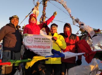
The primary objective is the Gosaikunda Lake basin, a cluster of high-altitude glacier lakes that are immensely strategic and spiritually important. We secure our base at 4,200m, positioned directly on the shores of the largest holy lake, surrounded by sheer rock face and ice-capped ridges.
The afternoon is reserved for sightings of the Surrounding water bodies, including Saraswati Kunda and Bhairav Kunda, as the thin air forces a disciplined, slow-motion pace.
The position serves you as your final high altitude outpost, offering a unique biological challenge as you sleep at the edge of the 4,000m threshold.
We will kick off the day with a massive vertical descent to drop 2,000m from the Sacred Glacial Basin back to the district headquarters.
We exit the high-altitude lake Zone and retrace our steps along the Lauribina Ridge, where the increased oxygen density begins to provide a natural performance boost to your system.
The mission transitions rapidly from the stark frozen Alpine Tundra back into the thicker Rhododendron and Oak Forest, passing through Cholangpati and Shing Gompa with high-speed efficiency.
As we descend, the air turns warmer, and the trail becomes softer underfoot, shifting from rocky ridges to the rich soil of the lower mountain slopes. Our final objective is Dhunche, the strategic administrative hub of Rasuwa district, which serves as the official mission end of the Foot-trip.
We secure our base at 2,200m by late afternoon, completing the full circle of the Langtang and Gosaikunda. The evening is spent in the bustling town, conducting a final equipment check, a debrief and celebrating the successful completion of the high altitude circuit before the vehicle extraction to Kathmandu tomorrow.
The final phase of the mission involves a tactical overland extraction from the rugged Rasuwa highlands back to the central capital. We initiate the six-hour vehicle transit in the morning, navigating the Serpentine mountain roads that cling to the edges of the Trishuli River Valley.
We descend from the mountains. The environment shifts from the quiet, thin air solitude to the Himalayas back to the vibrant high-energy bustle of Nepal’s urban heart. The journey provides a final opportunity to request a shift in the geological layers of the region, passing through the terraced hillside and rural bazaars, which served as the lifeline for the Northern Territories.
Upon re-entering the Kathmandu valley, we navigate the final urban checkpoints to reach your hotel base at 1,400m. The mission official concludes with a transition from the high altitude.
Back to the normal warm air, allowing for a comprehensive debrief and a celebratory final meal. This successfully region marks the completion of the 16-day circuit with all high altitude objectives secure and the extraction of the window successfully cleared.
The mission officially concludes today as you head towards the Kathmandu Valley to Tribhuvan International Airport.
After a final field breakfast at your hotel, we conduct terminal gear swift to ensure all personal equipment and high altitude data are secured for transit. You will be transferred to the International terminal of the airport via a vehicle by the travel company.
As you transition through the departure, get the operational window. For the 17 days, the Himalayan circuit is officially closed. The contrast between the chaotic energy of the capital and the silent, thin-air sanctuary you secured is a final reminder of the mission’s scale. Safe travels back to your home.
Welcome Dinner at the hotel
3-night hotel in Kathmandu
Kathmandu-Sybrubesi-Dhunche (On public transport)
Airport Pickup and drop
Breakfast, lunch, and dinner during the trek
Well-experienced Guide and Porter
Guide and porter insurance
Pre-arranged necessary Permits and paperworks
All required Taxes and charges
First aid kit
International flights
Nepal arrival visa cost
Extra food/beverages during the trek
Hot shower
Wi-Fi, Internet, Network
Personal expense
Tipping the crew members
Trekking equipment
Personal insurance (Helicopter evacuation)
Any damage (Trekking & hotel equipment)
Cost for unforeseen/natural events
Cost of early arrival and late departure.
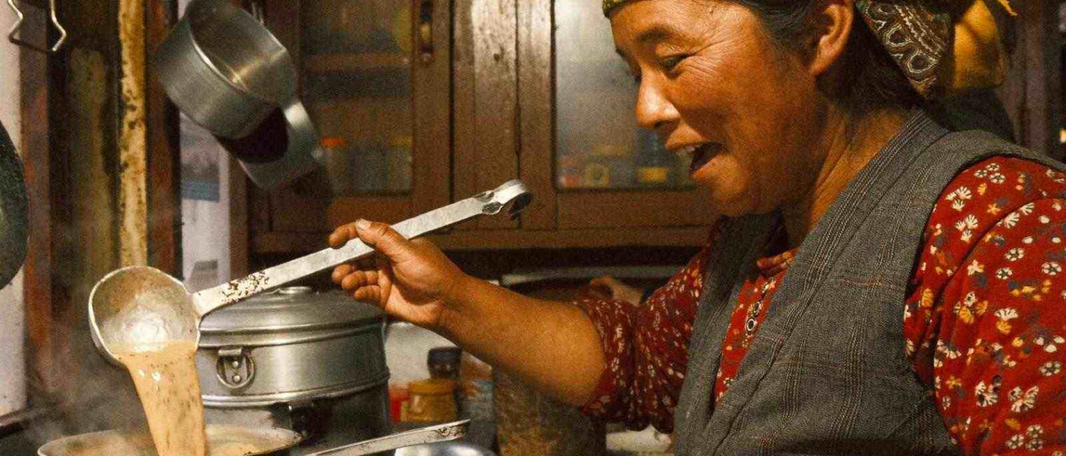
So this is how a day usually is. It begins with the morning lunch. You will usually wake up to a comforting breakfast brought to your door or served in the dining hall after packing your bags and handing your main pack to your porter. You. will have a warm breakfast that typically consists of oatmeal, eggs or Tibetan breads. By 7:30 to 8:30 AM, you are on the trail to catch the best mountain views before the afternoon clouds roll in.
This is the main trekking block. You will hike for three to four hours, taking short water breaks every hour. In the afternoon, you will stop at the trailside teahouse for a long lunch. This is more than just a meal. It’s a 60 to 90-minute break to rest your legs and hybrid before the final stretch of the day.
Most days end at your destination Lodge by early afternoon. This buffer time is Essential for acclimatisation. Once you arrive, you will drop your gear, change into dry camp clothes, and have a snack. You might take a shorter acclimatisation walk to a slightly higher reach nearby before returning to the lodge to rest, so that your body adapts to the high altitude for the upcoming trip the next day, which is slightly higher.
As the sun sets, the temperature drops, and everyone moves into the heated dining hall. This is the social highlight of the day, swapping stories with other trekkers, playing cards and eating a large dinner (usually dal bhat) by 8:30 or 9:00 PM. Most trekkers are in their sleeping bags to stay warm and prep for the next early start.
SIM cards: NTC Nepal Telecom generally offers the most reliable coverage in the Langtang and Gosaikunda regions.
Signal gaps: Expect long periods without services in the deep canyons. Most lodges in Kyanjin Gompa and Thulosyabru offer paid Wi-fi if you need to check in.
Safety: If you are heading into the 5000-meter summits, consider a satellite messenger like a Garmin InReach for emergency communication where there’s no cell service.
Battery life: Cold air at Gosaikunda and Tserko Ri drains batteries fast. Keep your spares in an inside pocket close to your body heat.
Maintenance: The lower trails are dusty, and the jungle zone is humid. Carry a microfiber cloth and a sealed bag to protect your lens from the elements.
Etiquette: Always ask for permission before taking portraits of locals or voters inside monasteries.
Local knowledge: A guide is invaluable for navigating the landslide debris in Langtang and explaining the traditions in the Tamang villages.
Logistics: A porter typically carries 15 to 20 KG. Letting them handle the heavy lifting allows you to enjoy the trek and manage the steep climbs with a lighter day pack.
Responsibility: Ensure your team has proper gear and insurance. Their well-being is as important as yours.
TIMS card: A mandatory registration for all trekkers used by authorities to track movement for safety.
National Park permit. You will need to enter the Langtang protected area. Keep it handy, as there are several checkpoints along the trail.
Helicopter evacuation: This is not negotiable to ensure your policies specifically cover emergency helicopter rescue up to 6000 meters.
Altitude limits: Double-check that your insurance doesn’t have a ceiling. Hit 3000m adds. Several of your stops are much higher.
Physical copy: Keep a printed copy of your insurance policy and the emergency contact number in a waterproof folder.
Most rooms are small twins sharing wooden cubicles with two single beds. Their walls are often thins to sound travels easily between rooms. While lodges provide full mattresses, pillows and blankets, they are rarely seen for the sub-zero nights at high altitude. Using your own -15 degrees Celsius sleeping bag on top of the lodge mattress is the standard for one’s hygiene.
The dining hall is the only heated room in the building, centred around a wood or yak-dung burning stove. This is where trekkers congregate in the evening to eat, dry out gear and socialise. Once dinner is over and the fire goes out, the temperature in the lodge drops rapidly to match the outside. So try to stay warm as much as possible by wearing proper clothes.
In the lower villages like Syabrubesi or Thulosyabru, you may find the attached bathrooms and gas-heated showers. As you go higher (Lama hotels, Gosaikunda), toilets are usually shared and located at the end of the hallway or in a separate outhouse. These are often squat style. Hot water for washing is usually available. Small fee ($3-$5), often provided in a bucket.
Autumn is widely considered one of the best times for the Tamang Heritage Langtang Gosaikunda Lake Trek due to the clear weather and atmosphere as a result of clean wash from rainfall, resulting in the sharpest and most high-contrast views of Langtang Lirung and the Tibetan peaks. The weather is predictable and dry, making the steep ascent to Tserko Ri much safer. While the days are crisp and perfect for walking, the nights above 4,000m start to drop well below the freezing point, requiring a heavy down jacket.
Spring is defined by colour and transition. As you walk through the Tamang Heritage villages, you’ll pass through massive forests of blooming rhododendrons ( Nepal’s national flower). The lower values are warm and vibrant with the bird and wildlife. As you climb higher, you will likely still find significant snowpack around Gosaikunda Lakes, which adds a dramatic arctic feel to the scenery. The air is slightly more humid than in autumn, which can lead to afternoon clouds.
Winter offers total solitude and intense blue skies. However, it is a season of extremes. The temperatures at Kyanjin Gompa and Gosaikonda can plummet to -15 degrees Celsius to -20 degrees Celsius at night. Heavy snowfalls can move the trail from Thulo Syabru to the lakes. Impossible to navigate without technical gear or a very experienced guide. Many lodge owners move to lower elevations, so your choice of accommodation will be limited.
The mountains are often hidden behind thick clouds, and the solitude comes at a price. The trail becomes slippery, and the forest sections around Lama Hotel are famous for leeches during this time. However, the flora is at its most lush, and the waterfalls in the Langtang Valley are roaring at full capacity. Landslides are genuine risks, often causing delays on the road from Kathmandu to Syabrubesi.
It’s customary to tip about 15% of the total cost at the end of the trip if you are happy with the service.