 Written By: Rajesh Neupane
Drone Permit in Nepal 2026: The Honest, Trek-by-Trek Guide Nobody Else Gives You
- Why Nepal Takes Drone Permits Seriously
- Understanding Who Issues What: The Three-Layer System
- Drone Categories Under CAAN – Civil Aviation Authority of Nepal: Which One Is Your Drone?
-
✅ Step-by-Step: How to Get a Drone Permit in Nepal as a Foreign Visitor
- Step 0 — Declare at Customs on Arrival (Non-Negotiable)
- Step 1 — Register Your Drone with CAAN
- Step 2 — Ministry of Home Affairs Clearance
- Step 3 — Apply to DNPWC or ACAP for National Park Permission
- Step 4 — Apply for a Filming Permit (If Applicable)
- Step 5 — For Dolpo and Restricted Areas: Apply for Restricted Area Permit
- Step 6 — Compile Everything and Carry Physical Copies on Trek
- 🗓️ Realistic Timelines: Start Earlier Than You Think
- 🏔️ Trek-by-Trek Drone Permit Breakdown
- 🚫 No-Fly Zones: Quick Reference
- ✅ What Happens If You Fly Without a Permit?
- 🌟 The Ethical Layer: Flying Responsibly on Trail
- 🎒 How Info Nepal Handles Drone Permits for Our Guests
- ❓ Frequently Asked Questions: Drone Permit in Nepal
- A Final Thought
Enquiry Form
There is a scene we have witnessed more times than we’d like to admit. A trekker arrives in Kathmandu, DJI Mavic tucked neatly in their pack, fully convinced that filling in a form on the CAAN website was all they needed. Two days into the Annapurna Circuit, drone confiscated at a checkpoint, they are standing in a teahouse trying to explain themselves over a cup of chiya they definitely did not budget for.
We are Info Nepal Tours and Treks. We have been handling permits for our guests — trekking permits, TIMS, conservation area passes, and yes, drone permits in Nepal — for years from right here in Kathmandu. And we are going to be completely honest with you: Nepal’s drone permit process is genuinely multi-layered, occasionally confusing, and almost never explained fully in one place.
This guide fixes that.
Why Nepal Takes Drone Permits Seriously
Before we get into paperwork, understand the why — because it changes how you approach the whole process.
Nepal’s skies are busy in a way most countries’ skies are not. Rescue helicopters fly multiple missions a day in the Khumbu. Medevac flights lift sick trekkers out of Manaslu villages at altitude. Near Lukla — one of the world’s most notoriously complex airports — aircraft operate in extremely tight corridors. An unpermitted drone in the wrong airspace is not just a legal problem. It is a genuine safety hazard.
Beyond aviation, Nepal’s national parks are home to wildlife that drones distress: snow leopards in the high Himalaya, red pandas in Langtang, rhinos in Chitwan. The Department of National Parks and Wildlife Conservation (DNPWC) takes this very seriously, and enforcement has increased significantly since 2024.
And then there are the monasteries, the stupas, the ancient Durbar Squares — places where the hum of a motor overhead is deeply unwelcome. This is not just about rules. It is about respect.
Understanding Who Issues What: The Three-Layer System
This is where most guides fail you. They tell you to “contact CAAN” and leave it there. The truth is that a drone permit in Nepal rarely involves just one authority. Here is the full picture.
Layer 1 — CAAN (Civil Aviation Authority of Nepal)
CAAN is your starting point and your primary permit-issuing body. Every single drone — regardless of size, nationality of the operator, or purpose — must be registered with CAAN before it leaves the ground anywhere in Nepal.
Layer 2 — Ministry of Home Affairs
For foreigners, for commercial shoots, for flights near sensitive zones, or for anything involving a border region, CAAN forwards your application to the Ministry of Home Affairs (MoHA) for security clearance. You do not go there separately — CAAN handles the referral — but it adds 5 to 15 working days to your timeline.
Layer 3 — DNPWC or ACAP/NTNC (for National Parks and Conservation Areas)
This is the layer most people miss entirely. If you plan to fly inside a national park or protected conservation area — and most of Nepal’s famous trekking regions are exactly that — you need a completely separate permit from the park authority. Which authority depends on where you are going:
- Sagarmatha National Park (Everest region): DNPWC
- Annapurna Conservation Area: ACAP, managed by NTNC
- Langtang National Park: DNPWC
- Manaslu Conservation Area: NTNC/ACAP
- Chitwan National Park: DNPWC
- Rara National Park: DNPWC
- Shey-Phoksundo National Park (Dolpo): DNPWC
- Upper Mustang (restricted area): CAAN + MoHA + Department of Immigration restricted area clearance
And for any shoot that involves actual filming or documentary-style content — even with a personal drone that you later post publicly — Nepal’s Department of Information and Broadcasting filming fee structure may also apply.
Drone Categories Under CAAN – Civil Aviation Authority of Nepal: Which One Is Your Drone?
The Civil Aviation Authority of Nepal classifies drones by Maximum Take-Off Weight (MTOW). Getting this wrong — say, applying under a recreational category when you plan commercial use — is itself a violation. Know your category before you apply.
| Category | Weight | Common Examples | Process Complexity |
| A – Very Low Risk | Under 250g | DJI Mini 3, DJI Neo | Full CAAN registration still required |
| B – Low Risk (Micro) | 250g – 2kg | DJI Air 3, Mavic 3 | CAAN + MoHA for foreigners |
| C – Small | 2kg – 25kg | Professional cinema drones | Full process + liability insurance mandatory |
| D – Large | Above 25kg | Industrial / film production | Special clearance, licensed crew required |
One thing worth saying plainly: Category A does not mean “no permit.” We have seen this misunderstanding cause confiscations on trail. Even your DJI Mini 3 requires full CAAN registration and a valid permit before you fly it anywhere in Nepal.
✅ Step-by-Step: How to Get a Drone Permit in Nepal as a Foreign Visitor
Step 0 — Declare at Customs on Arrival (Non-Negotiable)
This detail alone is worth millions. Walk through the wrong channel at Tribhuvan International Airport and the entire permit chain collapses.
When you arrive in Kathmandu carrying a drone, you must go through the Red Channel and declare it. You will receive a Customs Clearance Certificate. Without this document, CAAN will not register your drone — period. It does not matter if you have every other document in order. No customs slip, no permit.
Pack your drone in carry-on luggage so it is visible and declarable. Do not hope the Green Channel will be unstaffed.
Step 1 — Register Your Drone with CAAN
Visit the CAAN online drone registration portal — but have a backup plan ready. As of early 2026, the portal has experienced extended outages, sometimes for days at a stretch. If it is down, head in person to:
CAAN Flight Safety Standards Department (FSSD) Sinamangal, Kathmandu
You will need:
- Completed application form (RPA/Form/001)
- Passport copy, valid visa, and most recent entry stamp
- Clear photos of the drone showing brand, serial number, and colour
- Copy of the customs clearance certificate
- Drone manufacturer’s manual or technical spec sheet
- Proof of ownership (purchase receipt or warranty card)
- Overview of intended applications and flight locations with GPS coordinates
Registration certificates are valid for one year. Approximate cost: NPR 10,000–15,000 depending on category (roughly USD 75–115).
Step 2 — Ministry of Home Affairs Clearance
For foreign nationals, CAAN automatically refers your application to MoHA for security clearance. This takes 5 to 15 additional working days. You do not visit MoHA separately — but account for this time in your planning.
Pro tip from our permit desk: be extremely specific about your flight locations. GPS coordinates, named viewpoints, specific villages. Vague applications (“somewhere in the Annapurna region”) cause delays and sometimes rejections. CAAN officers trust specificity.
Step 3 — Apply to DNPWC or ACAP for National Park Permission
Start this application in parallel with Step 1, not after it. This is the single best thing you can do to compress your total waiting time.
The park permit is a separate application, separate fee, and separate process. Contact the relevant park headquarters in Kathmandu before your trek begins:
- DNPWC Headquarters: Babar Mahal, Kathmandu — for Everest, Langtang, Rara, Shey-Phoksundo, Chitwan
- ACAP/NTNC Headquarters: Khumaltar, Lalitpur — for Annapurna and Manaslu
Step 4 — Apply for a Filming Permit (If Applicable)
If your footage will be used commercially — sold, licensed, used in a YouTube channel that earns revenue, incorporated into brand content — the filming fee structure applies. Under Nepal’s current gazette provisions, even drone use “for purposes other than documentary” is subject to the cinematography fee schedule. The lines here are genuinely blurry, and we are honest with our guests about this. When in doubt, apply for the filming permit. The cost of not having it is far higher than the cost of the permit itself.
Step 5 — For Dolpo and Restricted Areas: Apply for Restricted Area Permit
If your trek goes into the Dolpo region or Upper Mustang, you need an additional Restricted Area Permit issued by the Department of Immigration in Kathmandu. This cannot be self-applied — it must go through a registered trekking agency. We handle this as standard practice for all our Dolpo and Mustang guests.
Step 6 — Compile Everything and Carry Physical Copies on Trek
Carry originals and copies of all documents in a waterproof folder:
- CAAN registration certificate with UIN (Unique Identification Number)
- MoHA clearance letter
- Park authority permit (DNPWC or ACAP)
- Filming permit if applicable
- Restricted area permit if applicable
- Your passport and visa
Digital copies on your phone are rarely sufficient at remote checkpoints. Our NTB-certified guides carry a physical permit folder for guests who fly drones on our treks — it has saved significant headaches more than once.
🗓️ Realistic Timelines: Start Earlier Than You Think
| Situation | Minimum Lead Time | Recommended |
|---|---|---|
| Recreational, non-park area | 1–2 weeks | 3 weeks |
| Recreational, inside national park | 3–4 weeks | 6 weeks |
| Commercial filming, any location | 4–6 weeks | 8 weeks |
| Commercial filming, Everest / Rara / Dolpo | 6–10 weeks | 12–14 weeks |
| Upper Dolpo commercial shoot (full stack) | 10 weeks | 14–16 weeks |
The CAAN portal outage issue adds unpredictability to every application window. If it goes down while you are mid-process, you are looking at an in-person submission and a longer wait. For remote treks like Rara and Dolpo, factor in domestic flight availability and weather disruptions on top of permit timelines. We recommend starting 10–14 weeks ahead if you are a foreign commercial operator planning to fly in a protected or restricted area.
🏔️ Trek-by-Trek Drone Permit Breakdown
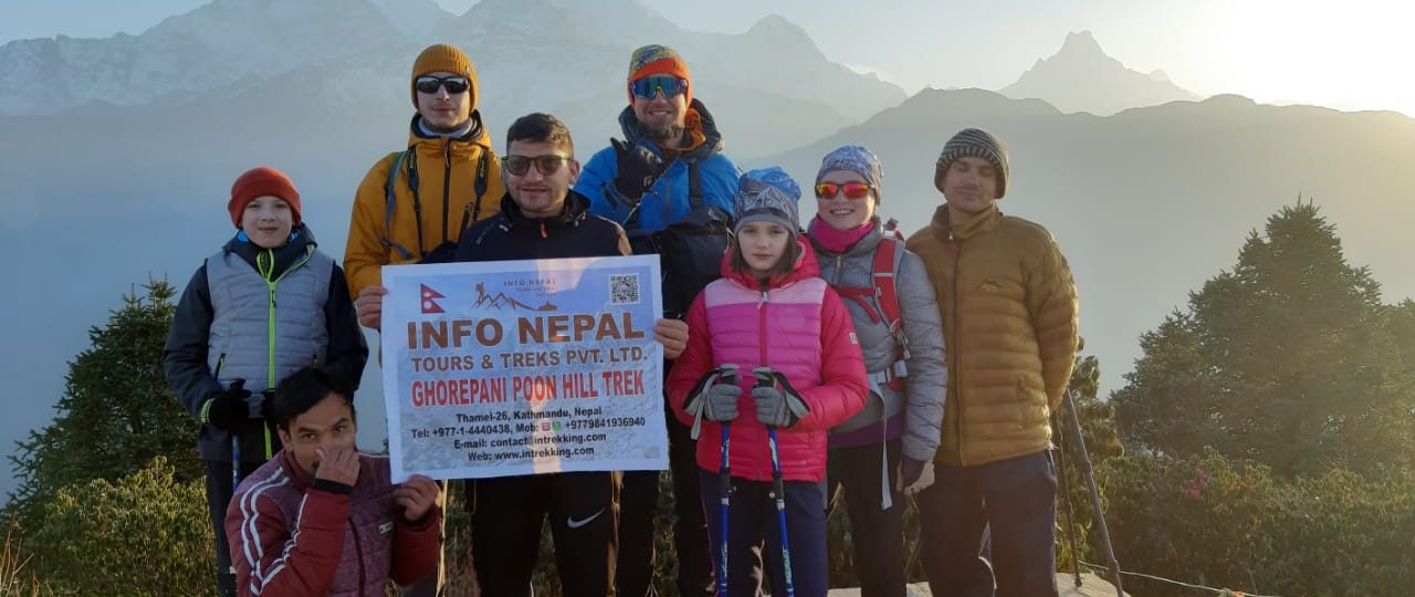
Drone Permit for Annapurna Treks (ABC, Circuit, Poon Hill, Mardi Himal)
The entire Annapurna region falls under the Annapurna Conservation Area, managed by ACAP and NTNC. Your CAAN registration and MoHA clearance must be supplemented with an ACAP drone permit. Flying without it inside the conservation area — even with full CAAN registration — is a violation.
This applies whether you are heading to Annapurna Base Camp, doing the classic Ghorepani Poon Hill loop, walking the full Annapurna Circuit, or exploring the quieter Mardi Himal trail. The conservation area boundary begins well before you reach the high mountain terrain.
Permit authorities: CAAN + MoHA + ACAP/NTNC
Lead time: 4–6 weeks for foreign nationals
Drone Permit for Everest Region Treks (EBC, Gokyo, Three Passes)
The Everest region is the most tightly regulated — and for good reason. Helicopter traffic in the Khumbu is constant, the altitude hammers battery performance (expect a 30–50% drop above 4,000m), and enforcement has intensified significantly in 2025–2026.
Beyond CAAN and MoHA, you need a DNPWC permit for Sagarmatha National Park. For foreign nationals, the documentary/filming fee from DNPWC is USD 1,500, with SAARC nationals paying NPR 50,000 and Nepali citizens NPR 10,000. An additional 25% applies if the drone is used specifically for documentary or filming purposes.
In the Everest region, you may also be required to have a government-appointed Liaison Officer accompany your shoot. You cover their food, accommodation, travel, and daily allowance. This is not a small cost — budget for it separately and explicitly.
The total outlay for legal commercial drone operation at or near Everest Base Camp can exceed USD 1,800–2,500 once all permits, liaison officer costs, and CAAN registration are accounted for.
Permit authorities: CAAN + MoHA + DNPWC (Sagarmatha National Park) + potential Liaison Officer
Lead time: 8–12 weeks for foreign commercial operators
Drone/filming fee (foreigners): USD 1,500 + 25% documentary surcharge
Drone Permit for Manaslu Circuit
Manaslu falls under the Manaslu Conservation Area, managed by NTNC. The permit process mirrors Annapurna — CAAN + MoHA + NTNC conservation permit. Manaslu is already a restricted area trek requiring a special permit, and drone permits add another layer.
One honest editorial note: Manaslu has far fewer trekkers than Annapurna or Everest, which means less social friction when flying. But fewer people does not mean fewer rules. Enforcement along the Manaslu Circuit has increased alongside the route’s growing popularity.
Permit authorities: CAAN + MoHA + NTNC/ACAP (Manaslu Conservation Area)
Lead time: 5–7 weeks for foreign nationals
Drone Permit for Upper Mustang
Upper Mustang is one of Nepal’s most dramatic drone destinations — the arid Tibetan plateau landscapes, ancient cave monasteries, and the walled city of Lo Manthang are genuinely spectacular from the air. But it is also a restricted area with a separate restricted area permit required, plus CAAN registration, plus MoHA clearance due to its proximity to the Chinese border.
The 5km no-fly zone from international borders applies strictly here. Do not guess where the border is. Know your GPS position at all times during flight.
Permit authorities: CAAN + MoHA + Department of Immigration (Restricted Area Permit)
Lead time: 6–8 weeks for foreign nationals
Drone Permit for Rara Lake Trek
Rara Lake is the most underrated drone destination in Nepal — and one of the most genuinely spectacular. Nepal’s largest lake, sitting at 2,990m in the remote Karnali Province, surrounded by deep forests and perpetual quiet. Fewer than a few thousand visitors make it there each year. The airspace is far less congested than Everest or Annapurna, and there are no helicopter corridors buzzing overhead every twenty minutes.
But do not let that openness fool you into thinking the permit requirements are lighter. Rara Lake sits entirely within Rara National Park, managed by DNPWC. A DNPWC documentary and filming permit is required in addition to your CAAN registration and MoHA clearance — the same fee structure applies: USD 1,500 for foreign nationals, NPR 50,000 for SAARC nationals, and NPR 10,000 for Nepali citizens. An additional 25% surcharge applies when the drone is used specifically for documentary or filming purposes. The park entry permit itself costs NPR 3,000 for foreigners plus 13% VAT.
One logistical reality worth knowing upfront: getting to Rara is itself a multi-leg journey — typically Kathmandu to Nepalgunj by flight, then Nepalgunj to Talcha airstrip by small aircraft, then trekking to the lake. Flight availability on this route is highly weather-dependent and can be disrupted for days. Factor this into your permit planning timeline — a delayed inbound flight does not extend your permit validity.
The drone photography potential here is extraordinary, though. The deep turquoise of Rara against its surrounding pine and oak forest, snow peaks lifting behind — it is the kind of aerial shot that simply does not exist in most people’s Nepal footage libraries. That rarity is worth the extra planning.
Permit authorities: CAAN + MoHA + DNPWC (Rara National Park)
Lead time: 6–8 weeks minimum for foreign nationals
Drone/filming fee (foreigners): USD 1,500 + 25% documentary surcharge
Drone Permit for Shey Phoksundo Trek (Lower and Upper Dolpo)
Shey Phoksundo Lake — turquoise, impossibly deep, ringed by the canyon cliffs of Dolpo — is perhaps the single most photogenic natural feature in Nepal that most people have never seen aerial footage of. That gap in the world’s drone photography archive exists for a reason. The Dolpo region is remote, expensive to access, and layered with some of the strictest permit requirements in the country.
Shey Phoksundo Lake sits within Shey-Phoksundo National Park, Nepal’s largest national park at 3,555 km², managed by DNPWC. The drone and filming permit fee structure here matches Sagarmatha and Rara: USD 1,500 for foreign nationals, NPR 50,000 for SAARC nationals, and NPR 10,000 for Nepali citizens, with an additional 25% surcharge when drones are used for documentary or filming. The drone fee for other purposes is equivalent to the documentary/filming fee.
But there is an additional layer specific to Dolpo that applies to no other trek on this list: the Restricted Area Permit. Lower Dolpo requires a restricted area permit at USD 20 per person per week, with charges for additional days beyond seven. Upper Dolpo — which includes the Shey Gompa and the more remote plateau landscapes — carries a significantly higher restricted area permit cost. And for both Lower and Upper Dolpo, you cannot apply as an individual, even through a registered agency. A minimum group of two trekkers is required.
So for a foreign drone operator in Upper Dolpo, the full permit stack looks like this:
| Permit | Issuing Authority | Approximate Cost (Foreigners) |
|---|---|---|
| CAAN drone registration | CAAN, Sinamangal | USD 75–115 |
| MoHA security clearance | via CAAN referral | Included in process |
| Shey-Phoksundo NP entry permit | DNPWC | USD 30 |
| DNPWC documentary/filming permit | DNPWC, Babar Mahal | USD 1,500 |
| 25% drone/filming surcharge | DNPWC | USD 375 |
| Upper Dolpo Restricted Area Permit | Dept. of Immigration | USD 500 (10 days) |
| Lower Dolpo Restricted Area Permit (exit routing) | Dept. of Immigration | USD 20/week |
| Liaison Officer costs | Variable | Budget separately |
Total permit expenditure for a commercial drone shoot in Upper Dolpo can comfortably exceed USD 2,500–3,000 before a single battery is charged. We are honest with anyone who asks us about this.
But Dolpo is extraordinary. The Tibetan plateau culture, the Bon-Buddhist monasteries carved into cliffsides, the landscape that genuinely looks like another planet — it rewards serious investment. Phoksundo Lake is a Ramsar-listed internationally significant wetland. The snow leopards, grey wolves, and musk deer that live in this park exist in part because the permit barrier keeps casual, unprepared visitors out. That is not a coincidence.
If Dolpo is your target for a serious aerial photography project, contact us three to four months in advance. We coordinate the full permit chain simultaneously — CAAN registration, DNPWC filming clearance, restricted area permits through the Department of Immigration, and the mandatory licensed guide arrangement — so you are not waiting for one process before starting the next.
Permit authorities: CAAN + MoHA + DNPWC + Department of Immigration (Restricted Area) + mandatory licensed guide + potential Liaison Officer
Lead time: 10–14 weeks strongly recommended for foreign commercial operators
Drone/filming fee (foreigners): USD 1,500 + 25% surcharge + Restricted Area Permit costs
🚫 No-Fly Zones: Quick Reference

Restricted Areas | No Drone Zones
| Zone | Restriction |
|---|---|
| Within 5km of any airport (includes Lukla, Jomsom, Talcha, Pokhara, Kathmandu TIA) | Prohibited |
| Within 5km of international borders (China, India) | Prohibited |
| Religious heritage sites (Boudhanath, Pashupatinath, Swayambhunath, Durbar Squares) | Prohibited |
| Military installations and government buildings (Singha Durbar, embassies, army barracks) | Prohibited |
| Within 1km of VIP residences | Prohibited |
| National parks and conservation areas | Requires DNPWC/ACAP permit in addition to CAAN |
| Congested areas / open-air gatherings above 1,000 persons | Prohibited within 150m |
Maximum permitted altitude: 120 metres above ground level
Maximum horizontal range: 500 metres from the pilot
Night flying: Prohibited for all operators
Minimum visibility: 5km horizontal
Visual line of sight: Mandatory at all times — no FPV-only flying permitted
✅ What Happens If You Fly Without a Permit?
Short answer: don’t.
Nepal’s police and army are equipped with drone detection technology at major hubs and popular trail sections. Local residents — who know these trails far better than any trekker — actively report suspicious drone activity. And enforcement officers have a financial incentive: fines from confiscation proceedings accrue to the authority.
The penalty structure as of 2026:
- First offence (no permit): NPR 25,000–100,000 (roughly USD 200–800)
- Repeat offence or commercial violation: NPR 100,000–500,000+ (USD 800–4,000+)
- Immediate drone confiscation — your NPR 100,000+ piece of equipment walks away with the officer
- Potential blacklisting from future trekking and climbing permits
- Deportation for foreign nationals in serious cases
We are not trying to scare you. We are being straight with you. The permit fees, even for the Everest or Dolpo region, look very reasonable next to those consequences.
🌟 The Ethical Layer: Flying Responsibly on Trail
Here is something none of the other guides say plainly enough. Even with a valid permit in your waterproof folder, you can still cause real problems on trail.
Many trekkers come to Nepal specifically for the silence. The wind on a ridgeline above Thorong La. The valley quiet at Annapurna Base Camp before the clouds roll in. The complete absence of mechanical sound at a remote gompa in Dolpo. A drone’s buzzing motor breaks that silence completely and immediately. We have heard from our own guests — guests who love photography — that drone noise from other trekkers genuinely affected their experience.
Fly early morning or late afternoon, when fewer people are at viewpoints. Keep flights short — five to ten minutes maximum before packing up. Ask nearby trekkers before launching. And genuinely consider: does this shot require a drone, or would a well-positioned camera do the job just as well?
Our certified photographers on trip have learned — sometimes the most powerful Himalayan image is taken from exactly where you are standing.
🎒 How Info Nepal Handles Drone Permits for Our Guests
We handle drone permit facilitation as part of our pre-trek planning service. Here is what that looks like in practice:
- We collect your drone specifications, serial number, and intended filming zones at the time of booking
- We begin parallel applications to CAAN, MoHA, the relevant park authority, and the Department of Immigration (for restricted areas) on your behalf
- We coordinate the customs declaration logistics with you before your arrival
- We maintain physical copies of all permit documents in your trail documentation folder
- Our NTB-certified guides carry the permit folder throughout your trek and know which checkpoints require presentation
Just show up — we handle everything. That is not marketing language. That is what we actually do.
If you are planning a trek with a drone, contact us at least 6–14 weeks before your departure date depending on your destination, so we have sufficient lead time for the full multi-ministry process.
📞 +977 9841936940
❓ Frequently Asked Questions: Drone Permit in Nepal
Can I get a drone permit in Nepal after I arrive?
Technically yes, but strongly discouraged. The process takes a minimum of 7–15 working days, and the CAAN portal frequently goes offline. If you arrive without having started the process, you may spend your first week in Kathmandu chasing paperwork instead of acclimatising. For Dolpo or Rara, the logistics are even tighter. Start before you land.
Does my DJI Mini 3 (249g) need a permit?
Yes. The “under 250g” threshold does not create a permit exemption in Nepal the way it does in some other countries. CAAN registration is mandatory for all drones regardless of weight.
Can I fly at Poon Hill?
Poon Hill sits within the Annapurna Conservation Area. You need CAAN registration, MoHA clearance, and an ACAP drone permit. All three, not just one.
Is the CAAN online portal reliable?
Honest answer: not consistently. As of early 2026, the CAAN drone registration portal has experienced significant downtime. Always have a backup plan for an in-person submission at the FSSD office in Sinamangal, Kathmandu.
Do I need a separate permit for every national park?
Yes. A permit for the Annapurna Conservation Area does not cover Sagarmatha National Park, Rara National Park, or Shey-Phoksundo National Park. Each protected area requires its own park-level clearance in addition to your CAAN registration.
Can I fly a drone near Rara Lake without going through a trekking agency?
You can attempt the CAAN registration independently, but the DNPWC filming permit application — especially for foreign nationals — is significantly smoother when handled through a registered Nepali trekking agency. For Dolpo specifically, it is not optional: the Restricted Area Permit legally requires agency processing.
What is the best weather window for drone photography in Nepal?
Spring (March–May) and autumn (September–November) offer the best flying conditions — clear skies, stable wind, good visibility. The Department of Hydrology and Meteorology Nepal publishes daily forecasts. The Windy.com app is what our certified photographers use for real-time high-altitude wind data. Monsoon months (June–September) are essentially unworkable for drone photography at altitude.
Does the Dolpo restricted area permit cover drone use as well?
No. The Restricted Area Permit covers your access to the region as a trekker. The drone/filming permit from DNPWC is a completely separate instrument. You need both.
A Final Thought
Nepal is one of the most visually extraordinary countries on earth. The aerial perspective — watching the Annapurna massif rise out of a sea of cloud, or the turquoise of Rara shimmering between forests you can barely see the edge of, or the impossible blue of Phoksundo Lake against the canyon walls of Dolpo — is unlike anything available anywhere else. We understand the pull completely.
But the permit process here exists for good reasons. It protects rescue airspace. It protects wildlife. It protects the silence that people travel from across the world to experience. Following it is not bureaucratic inconvenience — it is part of being a responsible guest in this landscape.
Get your permits properly. Fly with awareness. And make images that do justice to what Nepal actually is.
We will help you do exactly that.
📞 +977 9841936940